

Tell your friends about this item:
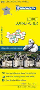
Loiret, Loir-et-Cher - Michelin Local Map 318: Map 13th edition
Michelin
Price
zł 39.90
Ordered from remote warehouse
Expected delivery Oct 10 - 21
Our customers say:

Add to your iMusic wish list
Loiret, Loir-et-Cher - Michelin Local Map 318: Map 13th edition
Michelin
Michelin local maps are on a scale of 1:150,000 up 1:220,000 with easy to read mapping using satellite images. With additional tourist information, these maps are ideal for planning your visit. Series for France and Italy.
Målestok: 1:150.000 Serie: Michelin local Map Serienr.: 318
| Media | Books Map (Land or nautical charts) |
| Released | April 1, 2016 |
| ISBN13 | 9782067210240 |
| Publishers | Michelin Editions des Voyages |
| Genre | Maps & Guides |
| Pages | 1 |
| Dimensions | 114 × 250 × 12 mm · 92 g |
| Language | English |
Show all
More by Michelin


Others have also bought
![Cover for Simon Ankjærgaard · Augustoprøret 1943 (Bound Book) [1st edition] (2020)](https://imusic.b-cdn.net/images/item/original/379/9788711983379.jpg?simon-ankjaergaard-2020-augustoproeret-1943-bound-book&class=scaled&v=1599570193)

![Cover for Annie Ernaux · Årene (Sewn Spine Book) [1st edition] (2021)](https://imusic.b-cdn.net/images/item/original/608/9788712062608.jpg?annie-ernaux-2021-aarene-sewn-spine-book&class=scaled&v=1606138432)
![Cover for Jamie Oliver · 5 ingredienser - Middelhavsmad (Bound Book) [1st edition] (2023)](https://imusic.b-cdn.net/images/item/original/706/9788727063706.jpg?jamie-oliver-2023-5-ingredienser-middelhavsmad-bound-book&class=scaled&v=1686186494)
![Cover for Giovanni Boccaccio · Dekameron (Book) [1st edition] (2019)](https://imusic.b-cdn.net/images/item/original/643/9788793279643.jpg?giovanni-boccaccio-2019-dekameron-book&class=scaled&v=1643723306)
![Cover for Jakob Martin Strid · Den fantastiske bus (Bound Book) [1st edition] (2023)](https://imusic.b-cdn.net/images/item/original/098/9788702152098.jpg?jakob-martin-strid-2023-den-fantastiske-bus-bound-book&class=scaled&v=1696053829)

See all of Michelin ( e.g. Map , Hardcover Book , Paperback Book , Book and Sewn Spine Book )